
Georeferencing
Fawn Rescue with GPS
The georeferencing process makes it possible to mark the fawn using GPS and then locate it, thereby saving a lot of flight time.
Unlike conventional search methods, which involve searching for fawns and other wild animals in the live image from the thermal imaging drone and interrupting the search whenever a potential find is made, our method involves flying, analysis and recovery in separate steps.
Our method is not limited to a specific UAV. It can be used with most drones available on the market, although the accuracy is lower than with our specially designed Flying Wildlife Rescuer. A thermal imaging camera is required, which stores the GPS positions and the location of the camera in addition to the images. The images should be stored in raw format every second.
Streaming the live image to a monitor or video glasses is not necessary, but it is helpful for the pilot.
Special Features of Fawn Rescue with GPS
* (when the sky is overcast all day, or in the morning until 9 a.m. when the sun is shining)
How Does Fawn Rescue With GPS Work?
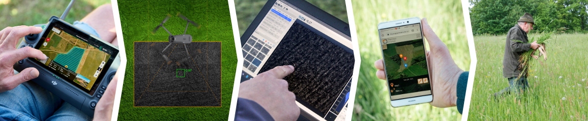
1. Fight Planning
First, the flight route is planned on a computer, tablet or remote control, which the aircraft then flies independently.
With flight planning, the UAV flies efficient, precise paths. Most aircraft manufacturers provide their own flight software that can be used to fly over areas automatically. In hilly terrain, a terrain-following mode, which some UAVs offer, is very helpful. It ensures that the camera always maintains the same distance from the ground, thus achieving the same image overlap every time.
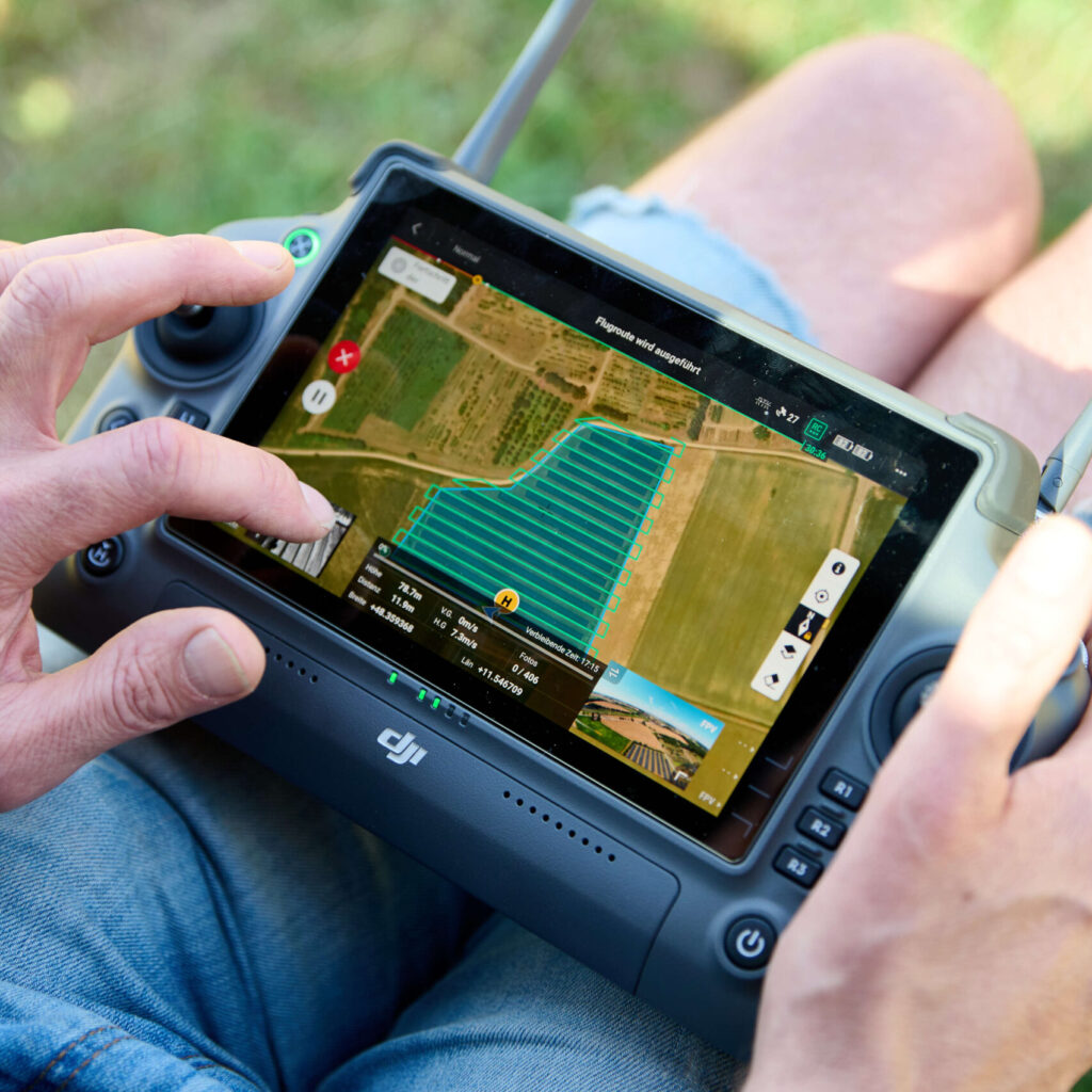
2. Flying
Now the planned area is flown over at an optimal altitude of between 50m and 80m. Images are captured every second and stored on an SD card.
Our procedure requires only one person. Since the pilot must keep an eye on the aircraft during the flight in order to be able to intervene in an emergency, our procedure does not require any further action during the flight. This is much less stressful for the pilot than most other procedures.
The downward-facing thermal camera takes images every second during the flight and saves them to an SD card together with the position and attitude data at the time of capture.
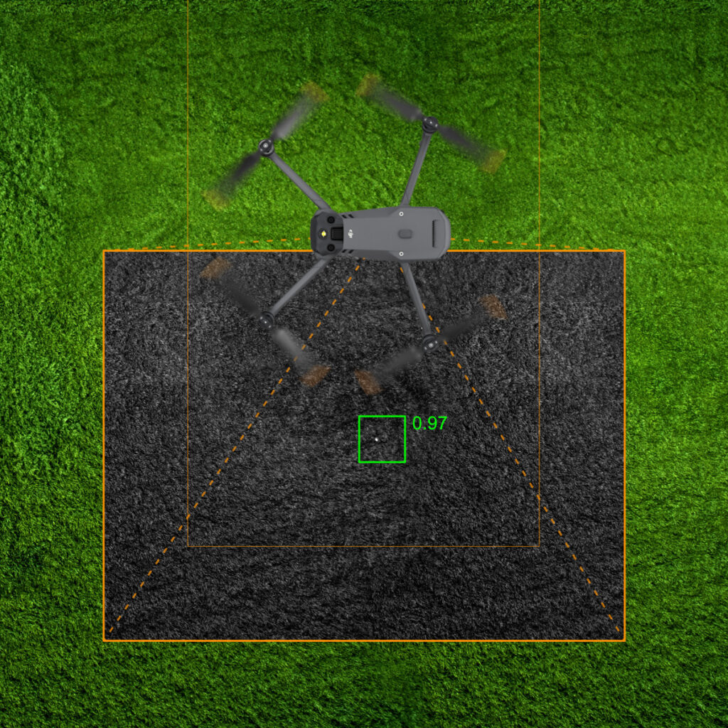
3. Analyse
After the flight, the images are evaluated. The flight attitude and position were saved at the time the image was taken. This means that the locations can be identified retrospectively.
There is special software for evaluating the images, which uses special image processing algorithms to improve image quality and can also locate the images, enabling the sites to be found using a navigation device. The sites can be transferred to a GPS device or smartphone, which can then be used to find the animals in the meadow.
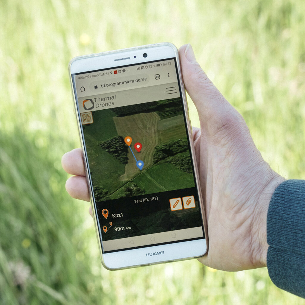
4. Find
The GPS positions of the locations can be easily accessed using our smartphone app. If there is no internet connection available in the field, the points can be transferred to a handheld GPS device.
Either transfer the GPS positions to an outdoor GPS handheld device via cable. Alternatively, you can upload the locations to a cloud and then use them via the Wildretter app on your smartphone. Since almost everyone has a smartphone these days, the task of rescuing fawns can be shared among many people.
5. Saving
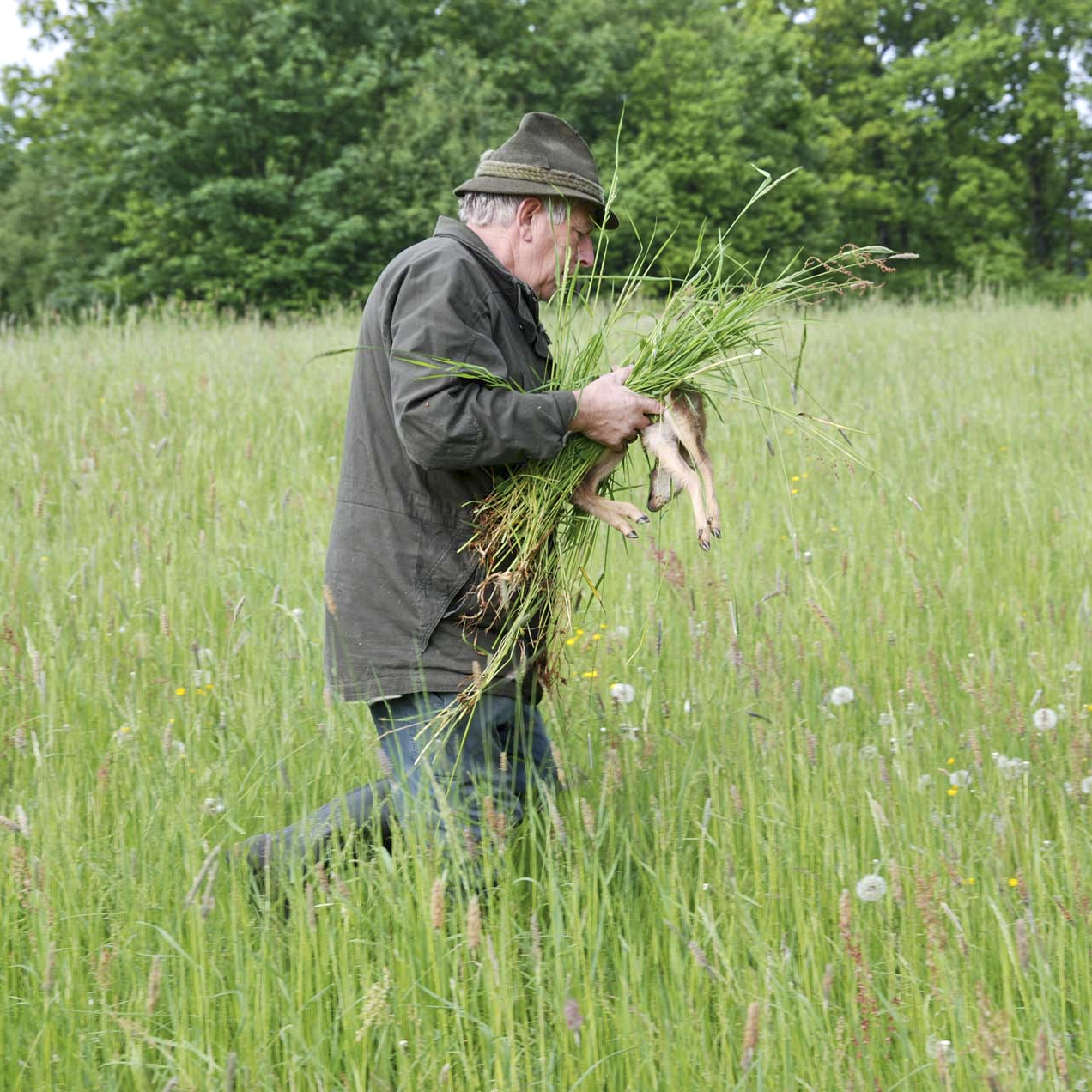
Once the fawn has been found, it is carried out of the danger zone.
The easiest thing to do is to carry the fawns out of the meadow. Don’t worry, the mother will definitely find them again, because she has been standing by in her hiding place the whole time, watching what is happening. The doe also communicates with her fawn by making squeaking sounds.
Das Gerücht, dass man das Kitz nicht anfassen darf, da die Mutter es sonst nicht mehr annimmt, wurde bereits in den siebziger Jahren wissenschaftlich widerlegt. Also: Keine Sorge, selbst wenn man das Kitz mit der bloßen Hand anfasst: Die Mutter nimmt es sicher wieder an! Wir verwenden aber trotzdem Grasbüschel, damit das Kitz seinen natürlichen Schutz – die Geruchlosigkeit – behält. Ohne einen eigenen Geruch wird es von Füchsen nicht so leicht gewittert.
Get started now with fawn rescue using GPS
The thermal DRONES POISuite is optimised for fawn rescue using GPS. It is included free of charge with every thermal imaging drone purchased from thermal DRONES. If you do not yet have a drone from thermal DRONES, you can try out the process for 14 days with our trial version.

Drone Sets for Wildlife Rescue
We offer tailored special sets for wildlife rescue. Only available from us, including our special software POISuite.