Calculation tools flight planning
How does the flight altitude affect the ground resolution (cm/px) of the thermal image for different drones, and what is…


How does the flight altitude affect the ground resolution (cm/px) of the thermal image for different drones, and what is…
Thermal imaging drones are now a valuable tool for nature conservation and species protection. Whether locating fawns before mowing, monitoring…

Flying in hilly terrain is not always easy. As a rule, an altitude of 50 metres is sufficient to fly…

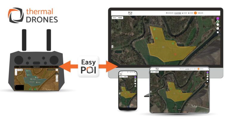
Just in time for the upcoming fawn season, we are pleased to introduce our new POICloud with the EasyPOI function.…
Using USB debugging and the program “scrcpy” (Screen copy), the screen of DJI remote controllers can be connected to and…

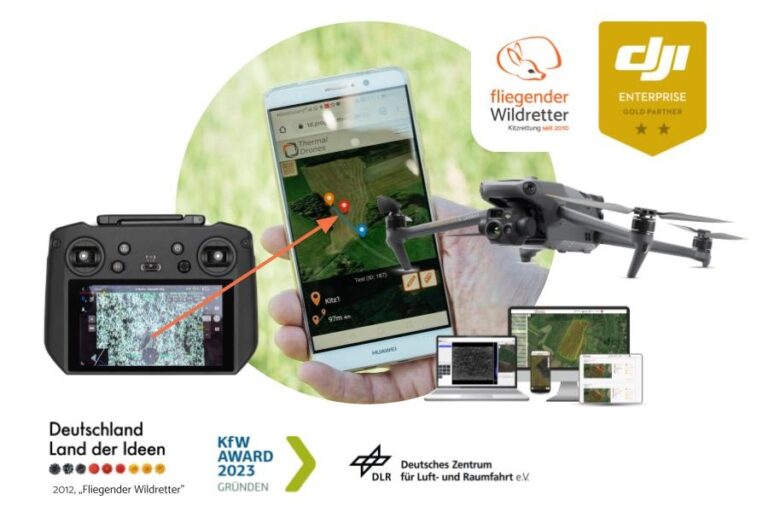
Transfer the position of the fawn from the remote control to the smartphone of the helpers with one click –…
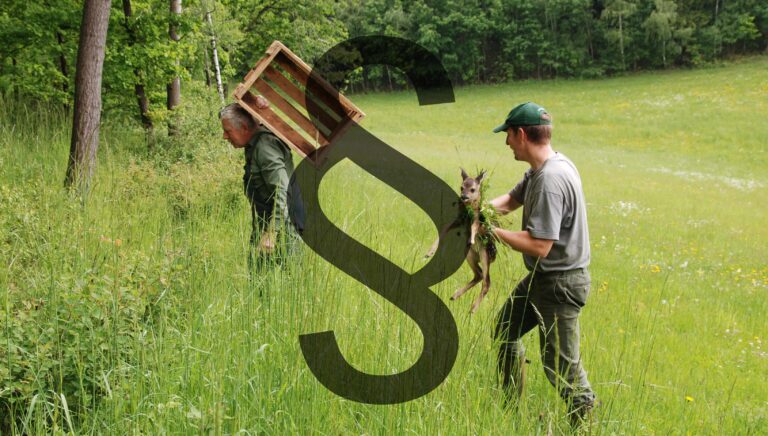
Anyone who has anything to do with fawns knows that you should not touch them with your bare hands. I…

You probably know what it’s like: when one person mows, everyone mows! The time pressure involved in fawn rescue is…

Poaching is regulated in Section 292 of the Criminal Code. This section protects the right of appropriation of the hunting…