
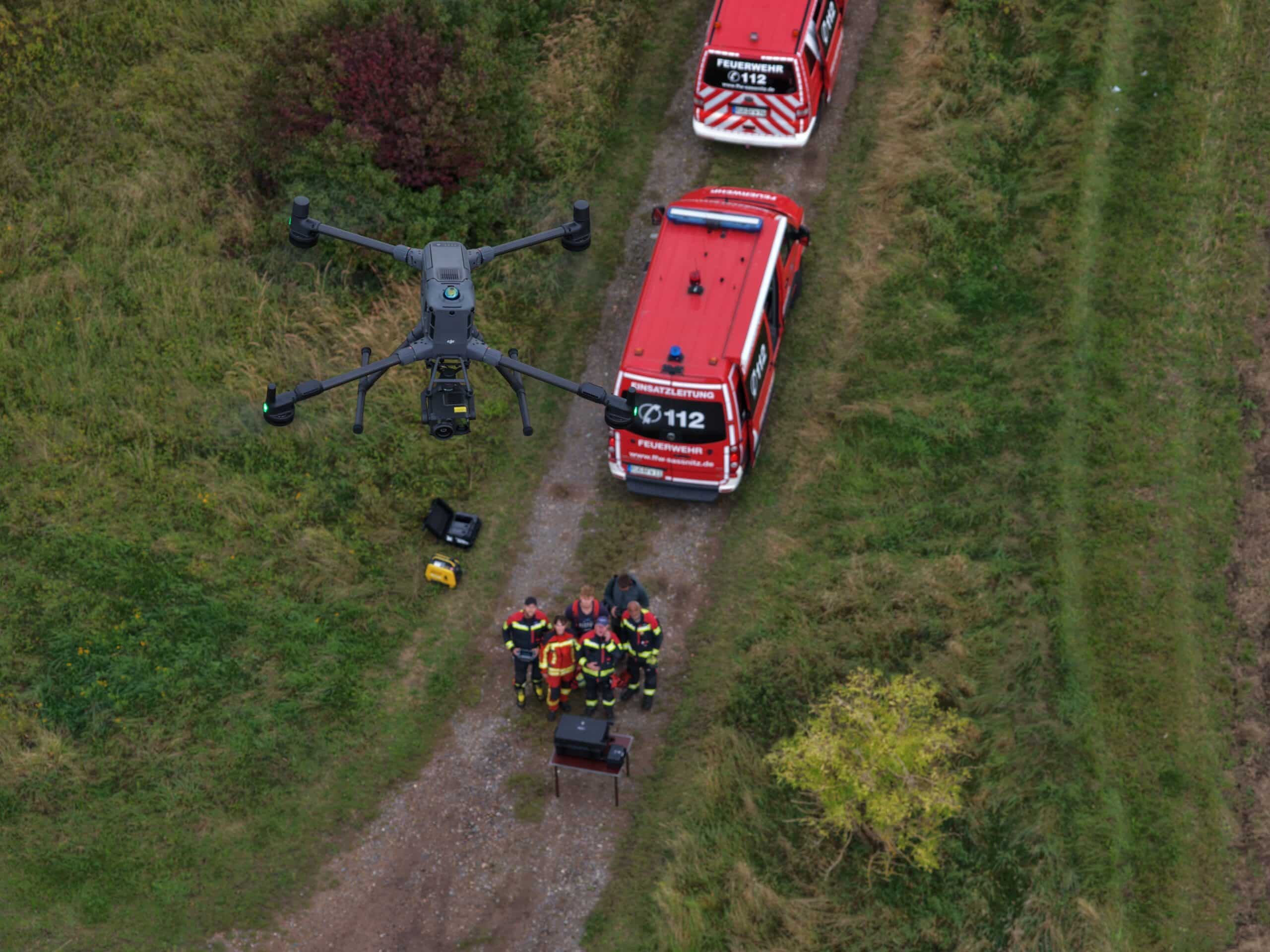
Drone software for emergency services
Drone live stream and situational awareness for fire departments and disaster relief
Drone images where decisions are made: POICloud transmits live images, thermal images, and the location of your drones to command centers, staff, and control centers. For fire departments, rescue services, the Federal Agency for Technical Relief (THW), and aid organizations – accessible via browser and without installation.
Drone deployment by the fire department
The drone sees everything. The command center often sees nothing.
Over one hundred fire departments in North Rhine-Westphalia alone now operate at least one drone, and drone units are also part of everyday operations for disaster relief organizations, the Federal Agency for Technical Relief (THW), the German Life Saving Association (DLRG), and mountain rescue services. However, the image is captured on the drone operator's remote control, often hundreds of meters away from the command vehicle, and usually never reaches the command staff or control center.
The expert recommendation from the German Fire Service Association (DFV) and the Association of German Fire Service Companies (AGBF) from August 2025 puts it succinctly: drones do not replace command and control processes; they accelerate situational awareness. The transmitted situational images must be integrated into command decisions, reviewed, processed, and analyzed. POICloud bridges precisely this gap from the drone to the command and control system: drone software for public safety authorities and organizations.
Situational awareness in the command process
Drone situational awareness for command and staff
Fire Service Regulation 100 specifies the most important requirement for situation assessment as its timeliness. POICloud supports the tasks assigned to the Situation Assessment section (S2) within this regulation.
-
Situation assessment
Live broadcast for situation assessment
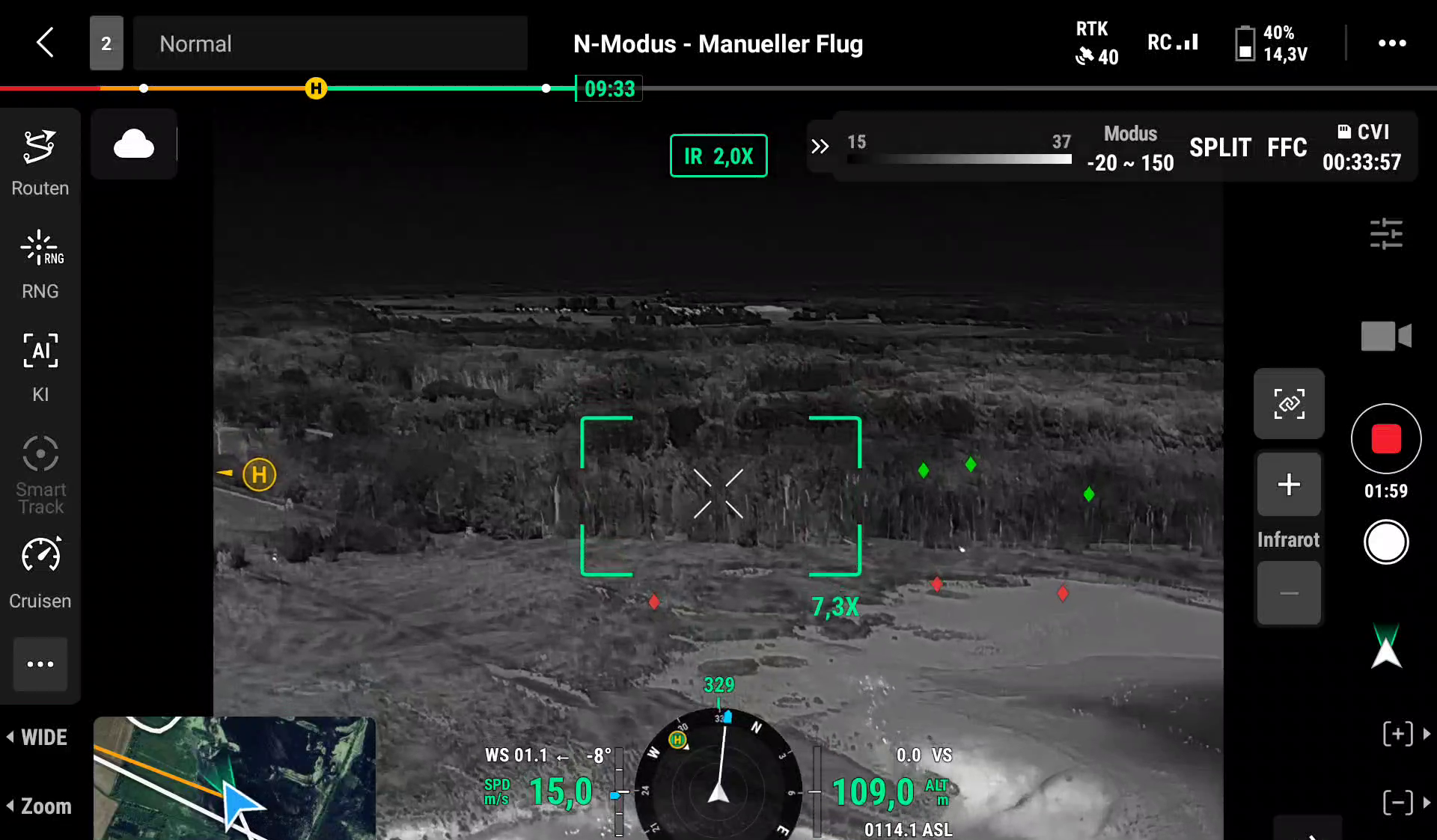
The drone's live stream runs in the command center's browser, with a delay of approximately three seconds. It includes color and thermal images, pinpointed on a map, along with the location of the drone, remote control, and team.
-
Location representation
Joint location map
Markers, search areas, and locations of finds appear for all participants on the same map, superimposed on official aerial photographs or a topographic map. An overview of the area is created from the aerial photographs.
-
documentation
Deployment documentation for follow-up
Flight paths, markings and find lists remain assigned to the operation and can be transferred as a PDF report or in open geodata formats, for example for the operation log or the command support software.
Image placeholder – Image concept: Interior of a command vehicle (ELW 2) or a command center. Two command assistants in front of a large screen, displaying the live drone feed on the left and a map with flight path and markers on the right. Actual operational clothing, no staged gestures, faces not in focus.
Drone video transmission
Live video from the BOS drone to any end device
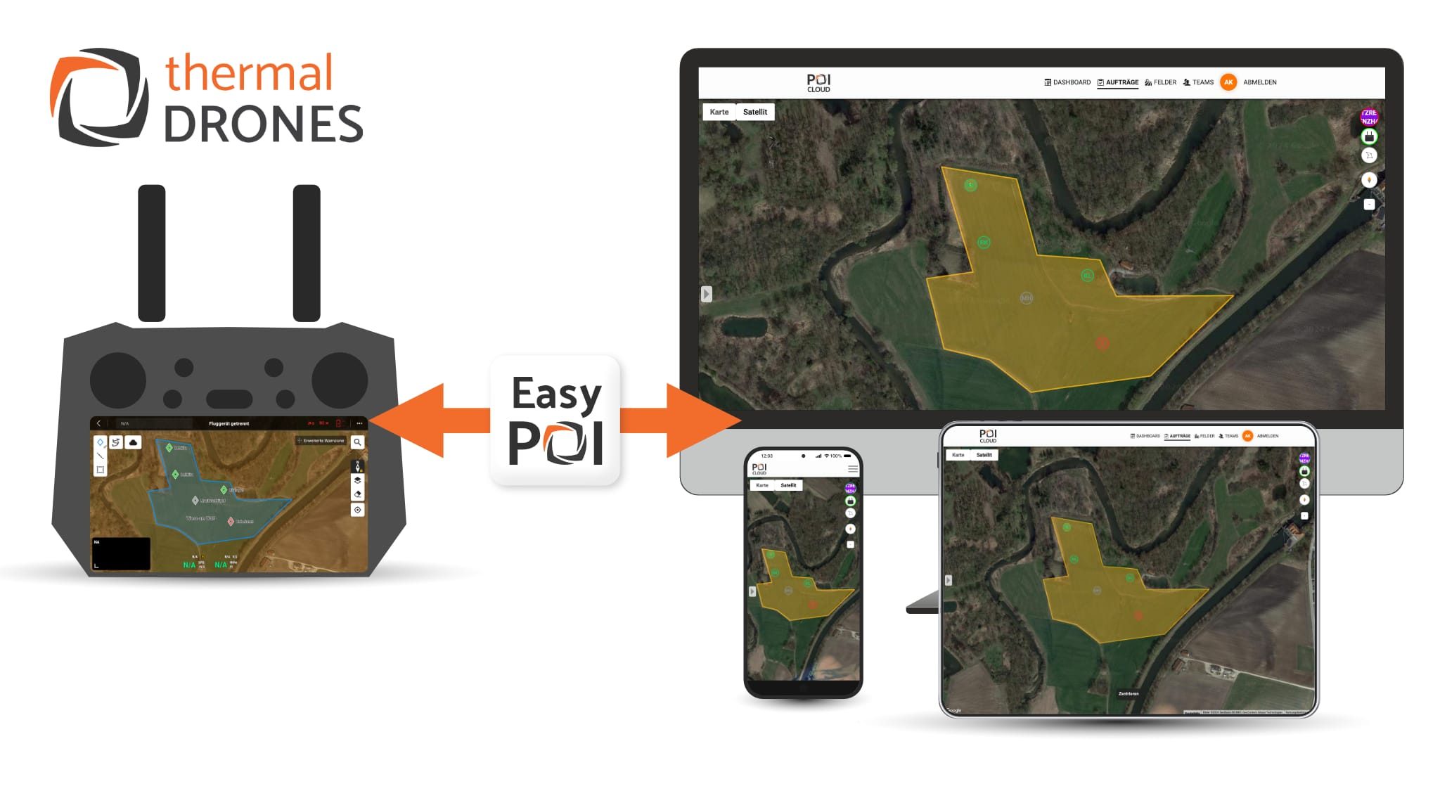
The drone registers with the POICloud via DJI Pilot 2. From then on, all authorized personnel can see its live image, its location, and every marker the drone operator places on the remote control: on the laptop in the command vehicle, on the section leader's tablet, on the screen in the staff room, or in the control center.
Features of the drone software for your use
-
Drone livestream in browser
The drone transmits its video feed to the POICloud streaming server. Command staff, command center, or control room can view it in any modern browser, on tablet, laptop, or large screen, without a separate app or installation.
-
Access via link, with expiry date
For the control center, a specialist advisor, or the administrative staff, you can issue guest access: as a link, QR code, or message, with an expiration date and individually granted permissions. Access expires automatically after the operation.
-
Real-time map for drones and emergency services
All drones, remote controls, and registered team members appear live on the map. Those operating multiple drones in a single operational area maintain an overview of all aircraft.
-
Thermal image on the map
The thermal imaging camera images are separate from the color images and can be overlaid on the map with adjustable opacity. This makes it possible to identify hotspots, heat sources, and search trails.
-
Markings from the controller
The drone operator places a marker directly on the DJI remote control, and it immediately appears in the POICloud, along with coordinates. The operations center can then check and confirm the location.
-
Overview image and orthophoto
Minutes after the flight, POICloud assembles the aerial images into a rough overview image (currently in testing). A precise orthophoto can be calculated for post-processing, also from thermal images.
-
Airspace and obstacles on the map
Geozones from the Digital Platform Unmanned Aviation (dipul), official aerial images and obstacles such as wind turbines or power lines can be displayed as a basis for risk assessment before takeoff.
-
Open formats instead of data silos
Export as KML, GPX, GeoJSON, GeoPackage, Shapefile, or PDF. A QGIS plugin imports tasks, areas, and markers directly into QGIS. The data remains reusable, even in other systems.
Deployment scenarios
Drone deployment in fire, forest fire, search and rescue operations and floods
-
Fire and subsequent extinguishing operations
Overview of the extent and spread of smoke, use the thermal imaging drone to find hotspots under rubble or in the roof structure and show the incident commander where further extinguishing is necessary.
-
Vegetation and forest fire
Track the fire front and hotspots over a large area from the air. The overview image and markings help in dividing the operational sector and in fire watch.
-
Search for persons and missing persons
The police are leading the search for missing persons. Firefighters, aid organizations, and search and rescue dog teams are providing support, and the POICloud shows all participating agencies the same live image from the thermal imaging camera and the same searched areas.
-
Floods and severe weather
Rapidly assess damage, flooded areas, and endangered dikes and relay the information to the crisis management team. The Rhineland-Palatinate state parliament's inquiry commission on the 2021 floods demands that a situation report be compiled as quickly as possible in the event of an incident.
-
Hazardous materials and major incidents
Observe the scene from a safe distance without sending emergency personnel into the danger zone, and share the overview with the incident command and technical advisors.
-
Water rescue
Search shorelines and water areas, for example with DLRG or water rescue services, and pass on the locations of finds with coordinates to boats and emergency services on land.
Sequence
Procedure for a drone deployment with the POICloud
The use of drones is under the command of the operations manager. They order, coordinate, and document it. The POICloud is integrated into this process.
-
1
Requirements and start
The drone unit is alerted and takes off after its risk assessment. The map showing geofences and obstacles is already prepared.
-
2
Live image to the command center
The drone's live video feed is displayed in the POICloud. The operations center connects other locations via a link, such as the control center or the staff.
-
3
Mark and rate
The drone operator or the aerial image analyst places markers, the operations management checks them and decides on the deployment of forces.
-
4
Update situational picture
Flight paths, searched areas, and locations of finds remain on the map. When command of operations changes, the new command adopts the same map.
-
5
Document and follow up
After the operation, you export the report and geodata for the incident log and follow-up. Your data protection policy determines how long the recordings are stored.
Honestly
What the drone software adds and what it doesn't
POICloud is not a map software with tactical symbols and does not replace command and control software, an incident management system, or an incident log. It provides these systems with what they typically lack: real-time aerial imagery, geolocated and in open formats.
The live image requires a data connection, usually mobile network. Video transmission is not possible via the BOS digital radio network; this is not technically supported by TETRA. If you anticipate weak network coverage at your incident site, we would be happy to discuss on-site solutions.
Legal framework
Legal basis for BOS drones: Section 21k LuftVO and EGRED 2
- EU regulations for unmanned aircraft do not apply to search and rescue operations, firefighting and similar tasks, according to the basic regulation (EU) 2018/1139, Article 2(3). However, the safety objectives must still be duly considered.
- According to Section 21k of the Air Traffic Regulations, authorities and organizations with security tasks do not need an operating permit for drones under 25 kg in connection with emergencies, accidents and disasters, and the geozone rules according to Sections 21h and 21i do not apply to them.
- This does not exempt the BOS (public safety organizations) from all regulations. The recommendations for common regulations on the use of drones in civil protection (EGRED 2) require a risk assessment in every case, and the exemption does not apply to demonstrations or public relations work.
- Aerial camera images constitute a particularly significant infringement on the rights of uninvolved parties. The legal basis for this is derived from the GDPR and the respective state law. According to EGRED 2, the data may be shared with crisis management teams and control centers to the extent necessary and must be deleted once the purpose has been fulfilled.
From the wildlife rescue
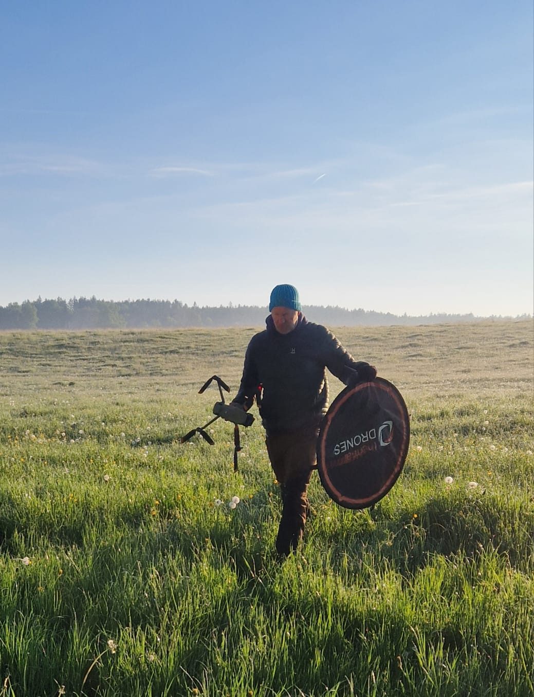
From the fawn rescue: Search using thermal imaging drones over a large area
POICloud originates from fawn rescue efforts. Every early summer, volunteer teams use thermal imaging drones to search large areas in the early morning hours, coordinating multiple drones simultaneously and relaying locations to ground crew. These same procedures are also used in searches for missing persons and for assessing damage situations.
equipment
Thermal imaging drone, software and training from a single source
-
Thermal imaging drones for emergency services
Drones with thermal imaging cameras from the DJI Enterprise series, as complete sets for fire brigades, rescue services and disaster relief.
Regarding the drones -
Training for your drone unit
Practical training courses at your location, including on searching for people using thermal imaging and for the fire brigade.
Regarding the training courses
Frequently Asked Questions
Frequently asked questions about drone software for emergency services
Do the control center or staff need their own software?
No. The live image and map run in a modern browser. You create a guest access account and send the link, for example to the control center or to a specialist advisor on staff.
How does the live image from the drone get to the control center?
The drone transmits its video feed to the POICloud via remote control and a mobile network connection. The control center opens the guest link in their browser and views the live stream without needing to install anything.
How much of a delay is there in the live image?
In the browser, it takes about three seconds. That's sufficient for determining the drone's position; the remote control is still used to operate the drone.
Which drones are supported?
POICloud works with drones from the DJI Enterprise series, including the Matrice 4T and 4E, Matrice 30T, and Mavic 3T and 3E. Please contact us if you are using a different model.
Is POICloud an alternative to DJI FlightHub 2?
For live streaming, shared maps, and transmission to command and control: yes. POICloud, like FlightHub 2, is integrated into DJI Pilot 2 as a third-party cloud service. Live video, locations, and markers are then routed through POICloud. It comes from a German provider and is designed for search, situational awareness, and documentation.
Can multiple organizations view a single image together?
Yes. Each organization operates within its own sphere, divided into departments and teams with roles for administrators, members, and guests. With guest access, other agencies only see what they have been authorized to view for the duration of the operation, such as the police during a missing person search.
Can I import the data into our management support software?
POICloud exports flight paths, areas, and markers in open formats such as KML, GeoJSON, GeoPackage, and Shapefile, as well as reports in PDF format. Many location and GIS programs can read these formats. We would be happy to discuss which import options are best suited for your system.
Does POICloud work without a mobile network connection?
A data connection is required for the live image and shared map. Individual steps, such as completing a task, are temporarily stored if there is no network connection and transmitted later.
Can we test the POICloud before purchasing it?
Yes. We'll show you POICloud in a demonstration. Just ask us.
Demonstration for fire brigade and disaster relief