Application area: species conservation
Breeding bird protection with drones: find, measure and monitor nests
Protecting breeding birds with drones means finding clutches, nests and eyries in a targeted way, measuring them from the air and protecting them without leaving traces on the ground. Here you can read what a thermal drone achieves for meadow birds, Montagu's harrier and white-tailed eagle, and how POICloud connects pilot, helpers and team.
The challenge
Protecting breeding birds that are hard to find
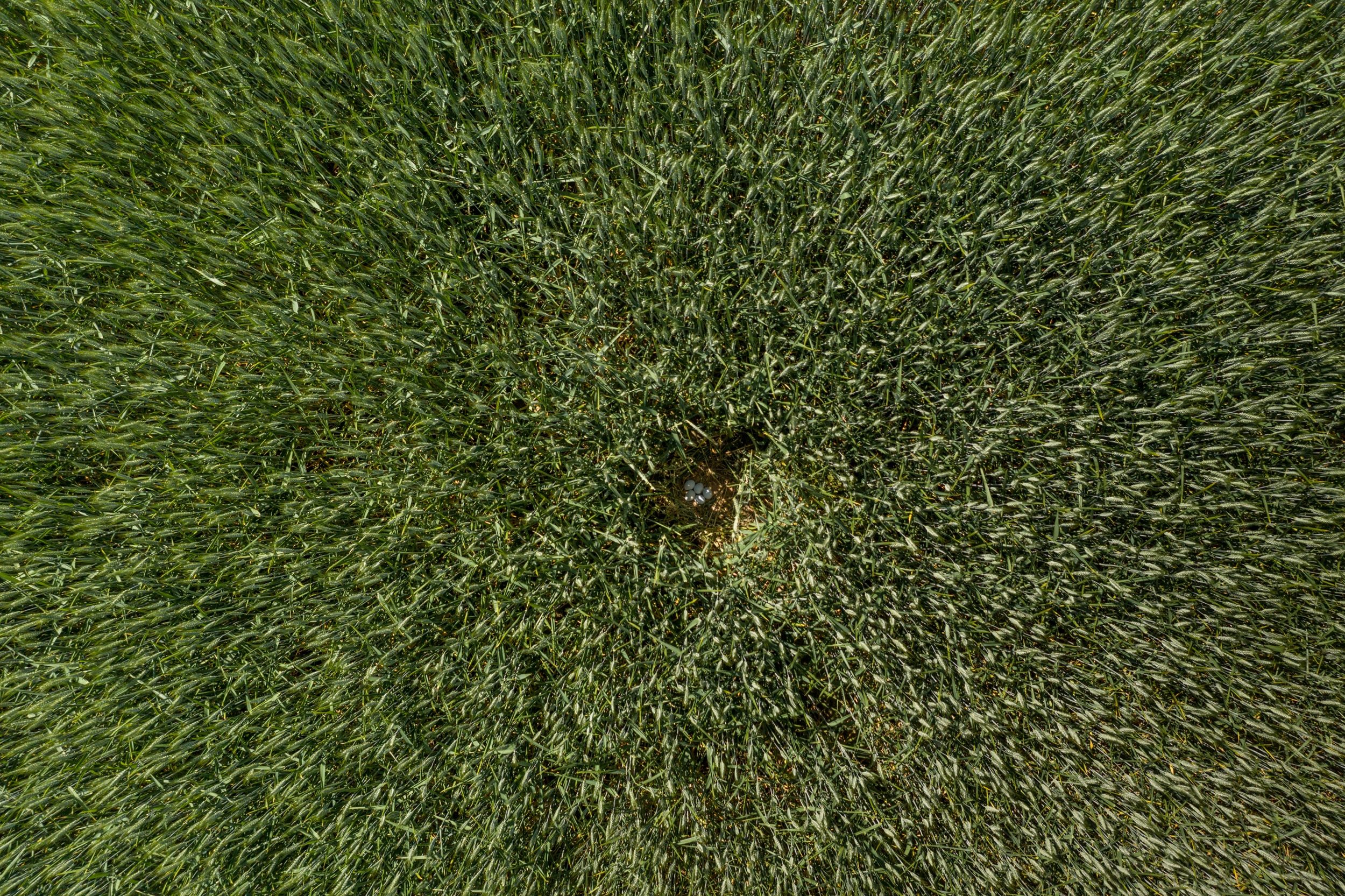
Lapwing, black-tailed godwit and Montagu's harrier nest on the ground, well camouflaged in meadow and field. There, mowing and harvesting, predators and disturbance threaten them. Anyone who wants to protect them must find the clutches first: over a large area, in a short time and without disturbing the brood.
On foot or with binoculars, this takes a lot of time. For the Montagu's harrier, following the female's flight from several vantage points takes several hours to days per nest. White-tailed eagle eyries are usually checked from the ground twice a year, in March and June. The result is often a high number of undiscovered and therefore unprotected nests.
What drones can be used for in breeding bird protection
-
Searching for nests and clutches
efficient and low-disturbance, even over large areas
-
Checking breeding status
check and document breeding status, progress and success
-
Searching for chicks
for protection during mowing, for ringing and as a success check
-
Analyzing habitats
orthomosaics, elevation models and point clouds support planning, monitoring of measures and research
-
Observing predators
record predators in the area
-
Public relations
make conservation work visible
Ground-nesting birds and waders
Protecting meadow birds on agricultural land
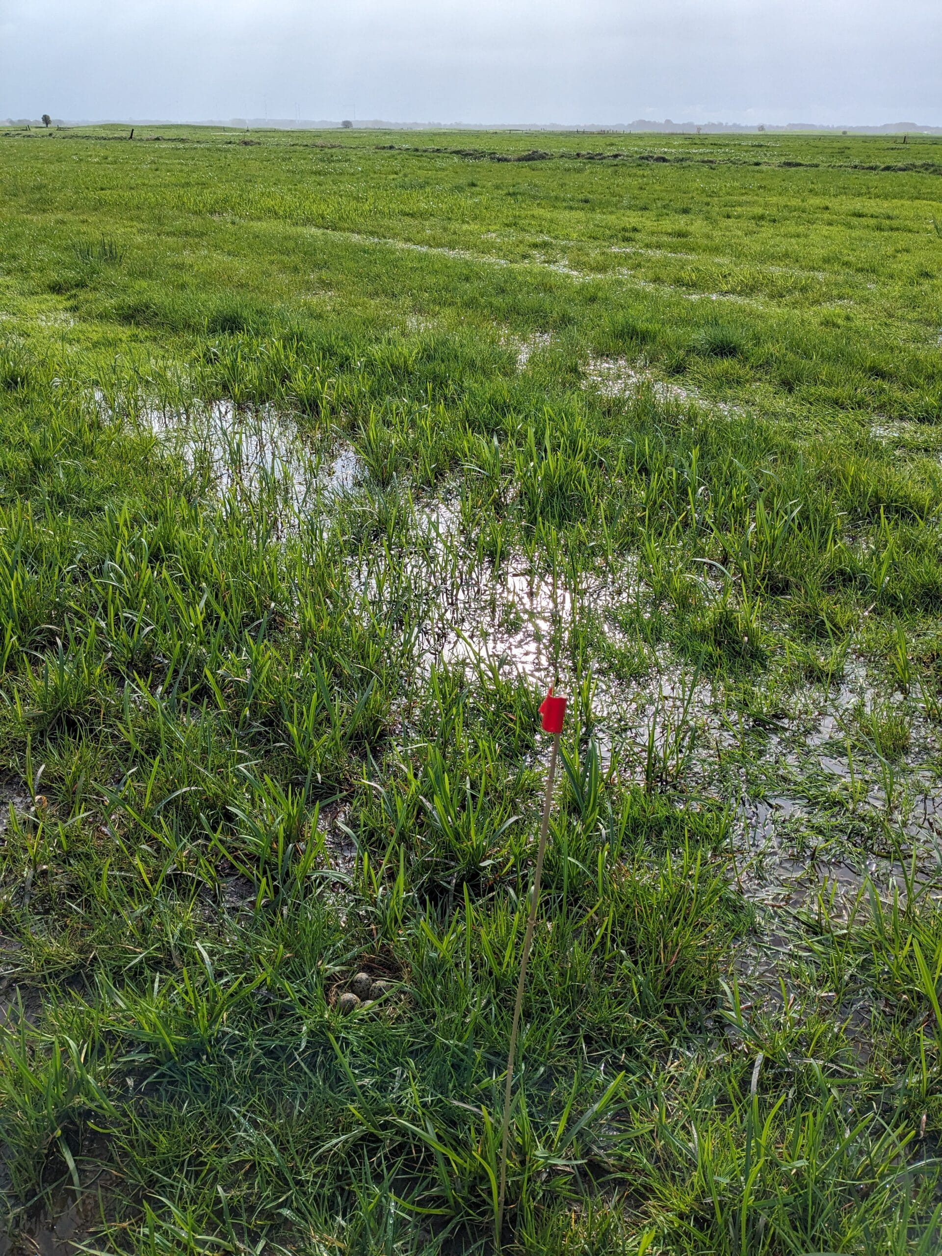
Black-tailed godwit, lapwing, redshank, curlew, common snipe, dunlin and ruff are the target species in meadow bird protection. Finding the nests of these species has become much easier with a thermal drone combined with POICloud and POIApp. On the ground, the POIApp guides helpers to the nest, and with the POIApp RTK receiver even to the centimeter.
On managed land, what matters is to find clutches and chicks before mowing, mark them and fence them off if necessary. The position can also be passed on to the farm machine as ISOXML.
Lapwing in thermal imaging
93% of lapwing nests found
One of the first publications on lapwing detection with thermal drones (Israel & Reinhard 2017) shows how a drone finds breeding birds: in the 2015 and 2016 breeding seasons, the authors found 93% of lapwing nests in 17 flights at three sites. The eggs are around 10 K warmer than their surroundings.
A good compromise is considered to be a flight altitude of about 40 m (contrast drops above 50 m) and a speed of about 2.5 m/s. That gives roughly 3 ha per flight. You see nests best in weak sun, so under overcast skies or in the evening.
With modern technology, flight speed has increased to 4 m/s and the area coverage is now almost 20 hectares per flight.
Single nest or area
Three methods for area mapping
With a single nest you know the approximate position and check it in a targeted way. With area mapping you record the whole population or parts of it, breeding and non-breeding animals. All three methods offer high area coverage with 100% productive flight time, less disturbance in the favorable temperature window, image optimization and lower staffing needs. The price is a more complex workflow.
-
With POIConnect
LiveView with georeferencing
You search in the live image and mark possible nests during the flight. The marker goes straight into POICloud.
-
With POIStudio
Analysis after the flight
The drone flies the area automatically and records images with RTK-GNSS. Afterwards you analyze them in POIStudio, with AI support if you like, and mark hotspots and possible nests.
-
With a second flight
Second flight for clarification
The drone approaches the hotspots a second time, accurate to 10 cm with RTK, and you filter the possible nests. Then the helpers walk to them with the POIApp.
The procedure in breeding bird protection
Four steps from search flight to protection
-
Fly
automatically with RTK-GNSS at 35 to 40 m altitude
Thermal images
-
Analyze
analyze thermal images in POIStudio with AI
Hotspots
-
Second flight
approach and determine hotspots to the centimeter
Finds
-
Protect
walk to the nest with the POIApp, record breeding status, fence it off
From practice
Practical examples from meadow bird protection
-
Eider-Treene-Sorge lowlands
1,400 clutches on 750 ha
In the community meadow bird protection project with Lokale Aktion Kuno e. V., the focus is on an area of 750 ha and 1,400 clutches. The team uses the DJI Matrice 30T and POISuite: POICloud plans and manages, POIStudio analyzes, POIApp records and protects.
-
Mönkebude polder, Life Limicodra
375 hotspots clarified
The drone flies automatically with RTK-GNSS, POIStudio marks hotspots and possible nests. A second flight clarifies 375 of them, and the POIApp records species and breeding status. The challenge: many nests and species, little time, no double counting.
-
Greifswald
Skylark: accurate to 10 cm
The first flight is automatic at 35 m altitude with RTK-GNSS, and you mark possible nests in the live image. In the second flight from 10 m, the drone approaches the hotspots accurate to 10 cm. Helpers walk to them with the smartphone app and the RTK module.
-
Greifswald
Grey partridge monitoring
The area is very large and the population small. The team collects sightings from Ornitho and from knowledgeable people, flies the areas for the first survey and then regularly for monitoring.
Measuring nests
Measuring the nest position from the air, accurate to the centimeter
With the DJI Matrice 4TD, a button press on the remote control is enough: the laser rangefinder and RTK GPS together measure the nest from over 100 m away, so you stay at a distance. POIConnect transmits the marker in real time to POICloud and to the POIApp on the team's smartphones. With the DJI Mavic 3T, too, you locate the find from the air and send it straight to the helpers.
Technology
Using the drone correctly: altitude, speed and overlap
Whether a nest stands out in a thermal image depends on ground resolution and signal quality. The guideline values come from our practical experience and from the research of Israel & Reinhard (2017).
| Setting | Guideline |
|---|---|
| Flight altitude | usually 35 to 45 m |
| Flight speed | 3 to 4 m/s |
| Overlap | 20 to 40%, so shading from vegetation does not interfere |
Birds of prey
Montagu's harrier: finding and protecting nests in grain fields
The Montagu's harrier breeds mainly in grain fields, where its clutch is threatened by early harvest and predation. It is on the Red List in category 2 (endangered); in Brandenburg there were still 23 confirmed breeding pairs in 2024. The few pairs are spread over several hundred km², so finding nests is the bottleneck.
This is how the association Wiesenweihen- und Naturschutz Nordostdeutschland works: gather observations from various sources, search with the drone in a targeted way at the sites of food passes, measure and fence the nests, and check them later with the drone.
From practice
Montagu's harrier protection in Brandenburg
According to the association Wiesenweihen- und Naturschutz Nordostdeutschland e. V., which has flown its own drone since 2023.
- 4
- previously unknown nests, found on the day the first drone was delivered
- +30 %
- more nests identified in the first drone year than the year before
- 3
- drones in use for Montagu's harrier protection
-
Wiesenweihen- und Naturschutz Nordostdeutschland e. V.
To the success storyWith thermal DRONES we were able to greatly reduce the time needed to locate nests, the POIApp in particular helped us. Since 2018 we have cooperated successfully on drone use in species conservation projects. Since 2023 we have flown our own drone and benefit greatly from the continuous development and the service.
White-tailed eagle and eyrie monitoring
White-tailed eagle: searching, measuring and monitoring eyries
The white-tailed eagle is Germany's largest bird of prey and, with around 1,000 breeding pairs (as of 2024), is considered not threatened. Its eyries can grow up to 4 m high and weigh 1 t. Traditionally, rangers and volunteers check known eyries twice a year, in March and June, from the ground with binoculars and spotting scopes. The difficulty lies above all in finding new eyries. On top of that come a lack of trained staff and tight budgets.
Breeding season: consideration comes first
White-tailed eagles are sensitive, especially in the breeding season between February and June. Improper drone use can endanger breeding success. Therefore only use drones through knowledgeable persons who are responsible under nature conservation law, or under their supervision. Information on the legal situation can be found under Drone law and in the letter to protected areas.
Technical possibilities
POICloud, POIApp and POIApp RTK: one platform for the whole mission
POICloud connects drone, team and everyone involved: fields, missions and finds are in one place. It grew out of fawn rescue, was developed together with hundreds of fawn rescuers and trained with thousands of thermal images. We transferred every development one to one to breeding bird protection and adapted it for clutches, chicks and breeding birds. In wildlife rescue, over 200,000 hectares have already been searched with the platform, and in breeding bird protection projects from Schleswig-Holstein to Bavaria work with it.
How it fits together
From the drone via POICloud to the team
- POIConnect Finds and live image directly from the remote control
- or POIStudio Analyze thermal images on the computer after the flight
-
POICloud
stores fields, missions and finds in real time
- Browser plan, monitor and control
- POIApp Helpers navigate to the find
- QGIS Process data further in GIS and other programs
Functions
What POICloud takes over during the mission
-
Flight routes automatically
POICloud creates the flight route from templates for your type of mission. POIConnect places it on the remote control in DJI Pilot 2, so you don't have to distribute anything.
-
Several pilots, one overview
Every connected remote control gets its mission from POICloud. Everyone sees all drones on one map.
-
Finds in real time
Find and live image go from the remote control to POICloud, and the helpers see them immediately in the POIApp. Their comments appear on the remote control.
-
Live image for everyone
A thermal or color image goes by link, without an account, to the control center and guests, in the POIApp and in the browser. Depending on the license, transmission is possible.
-
Reports and statistics
Statistics and reports are created along the way. You have documentation for every area.
-
Open interface
An open API for third parties and the path into QGIS and other GIS programs.
POIApp and POIApp RTK
Guided to the nest, accurate to the centimeter
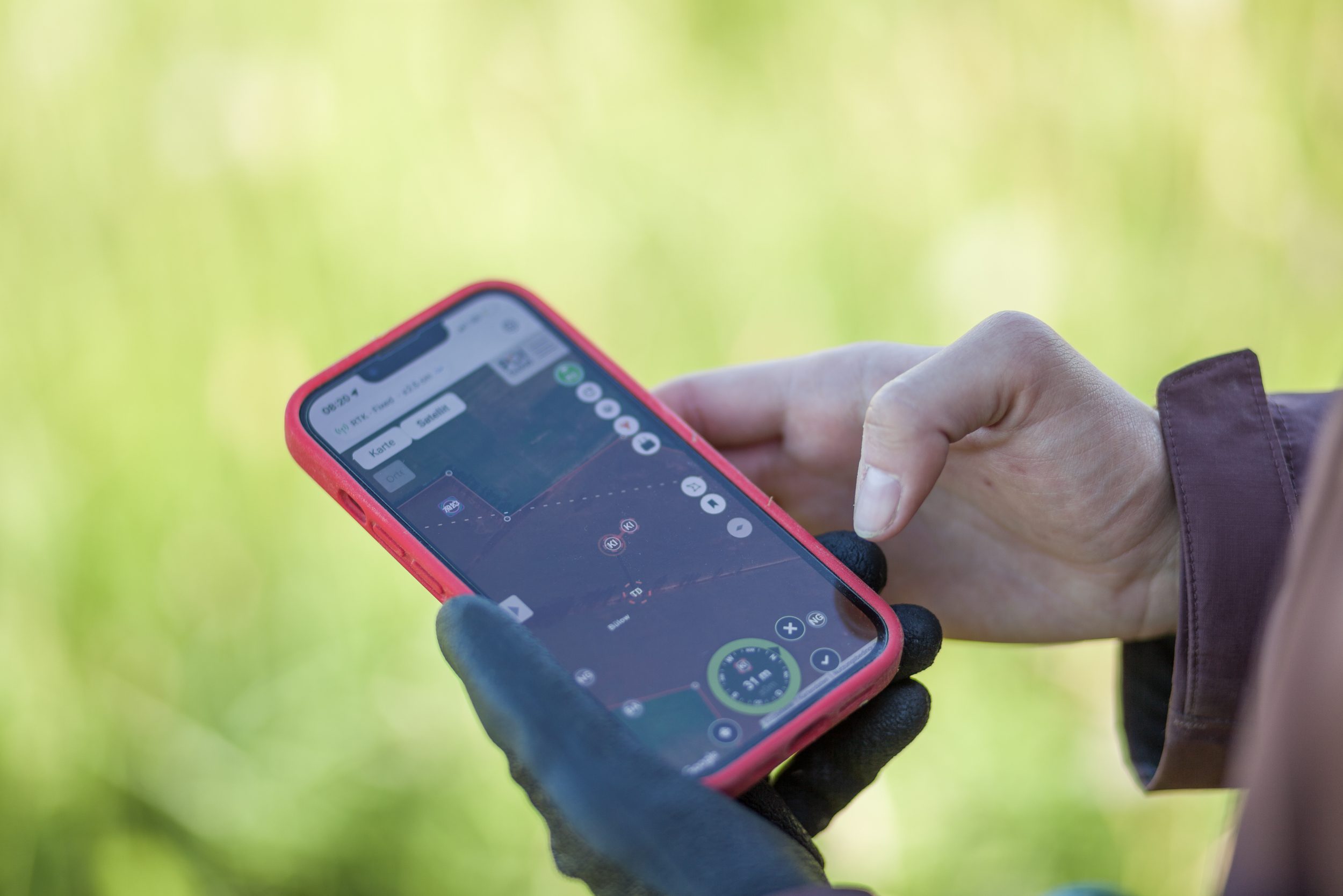
The POIApp guides the helpers to the find and shows the way right to the nest. With the POIApp RTK receiver, the smartphone becomes accurate to the centimeter, so you arrive exactly where the drone marked the find. In the app you confirm the find, record the breeding status, see the live image and coordinate with the team.
Equipment
Which drone suits breeding bird protection?
-
DJI Matrice 4TD
Weather-resistant thermal drone with cloud connection. Laser rangefinder and RTK GPS measure the nest from over 100 m away and so disturb as little as possible.
Breeding bird protection set in the shop -
DJI Matrice 5TD
The next generation of thermal drone with 4x thermal resolution and 11x optical zoom enables a new level of area coverage and even less disturbance.
Request a consultation now -
POISuite for existing drones
Already have a drone? POIStudio, POIConnect and POICloud with POIApp are also available individually. When you buy a thermal drone in the shop, they are included permanently free of charge.
POISuite in the shop
Frequently asked questions
Frequently asked questions about breeding bird protection with drones
Who may use drones in breeding bird protection?
Do drones disturb the birds?
Drones do have an effect on animals, and that has to be taken into account. In two theses on lapwing and curlew, no disturbance was detectable, with flights at 40 and 60 m altitude and more than 200 overflights. A study on the curlew names flight altitude as the key factor. Reliable conclusions need more data.
Can the drone find nests under vegetation too?
The high-resolution thermal camera of the DJI Mavic 3T and the DJI Matrice 4TD also detects nests under vegetation. The association Wiesenweihen- und Naturschutz Nordostdeutschland has used both models since 2023.
At what altitude do you fly when searching for nests?
Usually at 35 to 45 m altitude, in meadow bird protection mostly at 35 to 40 m, at 3 to 4 m/s and with 20 to 40% overlap. For lapwings, about 40 m is considered a good compromise; above 50 m the contrast drops.
When is the best time to search?
In weak sun, so under overcast skies or in the evening. In strong sun false alarms occur, and detectability depends on the time of day.
How precisely can a nest be measured?
With the DJI Matrice 4TD, to the centimeter: one button press on the remote control is enough, the laser rangefinder works together with the RTK GPS. How to set up RTK on the drone is explained in the article Setting up RTK positioning on DJI drones.
Does the AI recognize bird species?
Currently the AI in POIStudio recognizes living beings in general. With more training data it is meant to recognize species in future, and you can also use your own models. Whether it really is a nest is always decided by a human.
How do nest data get into GIS and onto farm machinery?
POICloud exports nest and protection area coordinates for GIS and farm machinery. How drone data ends up in QGIS is shown in Drone data in QGIS: POICloud plugin and API.
Advice